Monday 27 September 2010

dartmoor: yes tor and high willhays wild camping

Yep, another wild camp on Dartmoor. This time though, I wasn’t alone, and the mist didn’t feature.

Phil and I headed up onto the Okehampton Range to do a walk up to Yes Tor (highest tor on Dartmoor) and High Willhays (the highest point on Dartmoor, and indeed the highest point in Devon), which are satisfyingly right next to each other. The depressing part of the enterprise, however, was the fact that this particular section of Dartmoor is far from remote or wild – you are only minutes away from some of the Range tracks and indeed some sections of track that seem to be open to public traffic!!

We parked in the village of Belstone and walked up across the range from there, which meant that our walk up took a fair while and was almost entirely on vehicle tracks (apart from the section of bog I decided to take us through in the name of a ‘shortcut’ – served me right when I ended up knee-deep in the mire…). So the walk was rather dull, the area was busy, and the views were frankly rather boring too (ok so I’m spoiled by the mountains – barren moorland simply doesn’t inspire), BUT, that said, we did have a nice time camping near the top of High Willhays once we’d found a suitable spot.

The walk back down was a bit better. Neither of us could face the tedium of returning down the same old Range tracks, and so we headed off down to Dinger Tor and across the moor (on mostly good tracks) up to Oke Tor from where we followed a rather lovely ridge path. Higher Tor and Belstone Tor were also taken in before we headed back down through Nine Stones to the village…and on to a cream tea!

SDC11725

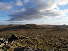
High Willhays, seen from Yes Tor

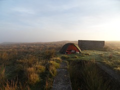
SDC11742

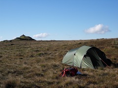
Our camp site, the cairn on High Willhays visible in the background

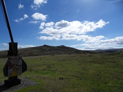
SDC11765

  The view from the Range marker just as you leave Belstone village – the ridge of Tors just visible

Phil will hopefully now feel a little happier out on the hill with his mates (or even, lord forbid, on his own!) as we spent a good portion of the walk back doing some basic navigation drills, some of which he’d not done before, and all of which were good practice for me. It did all make the dull bits a little more fun too!
Thursday 23 September 2010

dartmoor wild camp

Walking up under crystal skies, I watched the sun’s embers slowly burn out over the horizon, moisture rising from the moors. Gradually enveloped by a thick blanket of mist, the world was soon bathed in a simple diffused moonlight, warm, delicate and calming to the soul.

I will admit to finding it all a little unnerving at first, sat within my little orange cocoon, staring out at nothing but a gentle off-white world, but the moon appeared occasionally through the mist. It felt like he was watching over me, relaxing my mind, encouraging me to see the beauty of the world from a less cluttered perspective. After a while I wasn’t scared anymore.

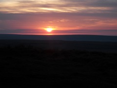
SDC11559

The sunset just as I crested the rise near Puper’s Hill

SDC11595

Moorland through the mist and my guardian moon

SDC11597

The campsite by the old China clay tramway during a brief, blissful clearing of the mist on the tops

SDC11608  

Heading home

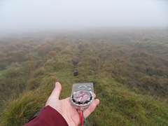
Whilst I’d come to accept the moorland mist in the night, in the morning I was delighted to see it lift and gift me back my vision for a while, enabling a wonderful clear view of the hilltop, and the cotton wool still filling the valleys. Unfortunately (or fortunately from a navigational test perspective), this break in the white mask only lasted as long as breakfast, and no sooner than I’d finished drinking my tea, I was once again back in the damp, relying on my compass to guide me home.

Monday 20 September 2010

devonshire place names, part 4

Do I need to say more? I didn’t think I’d be posting many if any new funky place name entries, but today I found these two ‘hamlets’ in remarkably close proximity to each other:

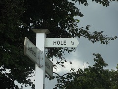
Hole. Wouldn’t you love to live in a place called Hole? Just for the novelty.

SDC11526

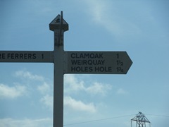
Holes Hole!!! Huh?

SDC11525 

Utter genius, I mean seriously? Holes Hole? I’d love to know the origins of some of these names…

Sunday 19 September 2010

devon: redux

The land of clotted cream teas and the Hound of the Baskervilles, yes, I’m back in Devon again, this time for a month or so. Sadly this isn’t a month-long cake and climbing orgy, but a month of driving and work again (for anyone unfamiliar with this blog, I came down here back in March for two weeks to work doing some radio drive testing, and now I’m back doing it again, but in more detail and with slightly modified kit). Despite having my climbing and outdoorsy-ness suddenly curtailed, I am actually glad to be down here as a) I’m earning money and b) I’m going to spend some time on Dartmoor. Hell I may even wangle c) some climbing in Cornwall…

So anyway, the blog may be a bit quiet for the next month or so, unless anything interesting happens. The vast majority of my time will be spent simply driving, although the nature of the roads and the area mean that ‘simply driving’ can be somewhat more difficult than one might think…

SDC11512

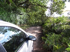
Yes, that is a tree across the road. Yes the road was a very narrow single track where I couldn’t turn around. Yes I had to reverse back up it through the ruts and with both wing mirrors in the hedges on each side simultaneously. Yes it was about half a mile back to the junction where I could finally turn. Yes I was laughing the whole time.

Thursday 9 September 2010

bumblie’s bimbles 2: aran fawddwy

For anyone that knows me, the idea that I have decided to gain the Mountain Leader qualification may be rather suprising, but there you go, I’ve registered with the MLTW and have a log book and everything, I just need to fill it.

And that’s why I’ve managed to get up off of my lazy butt and go for another decent hill walk, up another mountain I had yet to experience – Aran Fawddwy.

Situated not far from the village of Dinas Mawddwy, Aran Fawddwy is the 16th highest peak in Wales at 905m (and is only 9m off being classed as one of the Welsh 3000’ers), but being relatively inaccessible is actually pretty quiet.

The route I took went from Cwm Cywarch (parking, and also a massive set of crags I’m desperate to climb on, so if anyone fancies some slightly adventurous rock climbing and would be willing to head back here with me, please drop me a line!), up to Waun Camddwr, along the ridge bog boardwalks, across a completely unnecessary section of marsh where I realised that not following the fence had been a mistake, back to the fence line and up to the summit. The descent was back down Drws Bach, past the cairn (which is a memorial to Michael Robert Aspain a member of an RAF Mountain Rescue team based in St Athan who was killed there by a lightning strike in 1960 whilst on duty. He was 18 years old.) and onto Drysgol, eventually heading down the long dull slog of a path back to Cwm Cywarch.

Have some pictures.

SDC11410

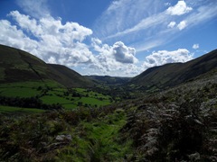
A pretty valley view

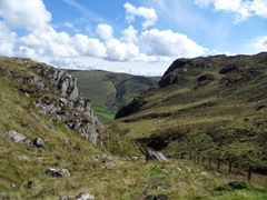
SDC11421The view back down the edge of Craig Cywarch  

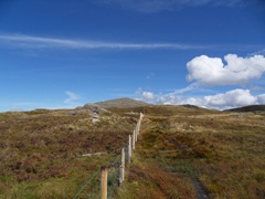
SDC11424Aran Fawddwy for the first time, still a horribly long bog slog away

Saturday 4 September 2010

a Swiss holiday part 2: the valleys and being a tourist

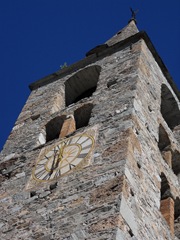
SDC11196 The church tower in Evolene (definitely a tourist photo!)

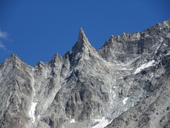
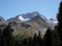
SDC11208 The Aiguille de la Tsa (or Tza) – a peak I really want to go back and climb, it is also known as the Matterhorn of Arolla valley due to it’s unmistakeable shape

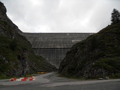
SDC11290 The Grande Dixence Dam, tallest gravity dam in the world at a mind boggling 285m high – well worth a click on the link to see some info about it, this dam is one of the start points for the approach to the Dix hut

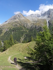
SDC11314 Phil on the walk up to Lac Bleu

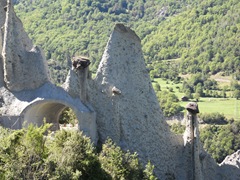
SDC11365 The Pyramids of Euseigne, bizarre features naturally sculpted out of moraine left behind by a retreating glacier – you actually drive through these on the drive up the valley to Evolene and Arolla. Very very weird.

a Swiss holiday part 1: the Pigne d’Arolla

Another long silence for which I will apologise, despite knowing that no-one cares about the apology…

I arrived back home late on Thursday after a marathon drive home from Arolla, Valais, Switzerland. Yes, I’ve been back to the Alps! This wasn’t an ordinary Alpine climbing trip though, this trip doubled as mine and Phil’s summer holiday, and also my first meeting with Alex*.

Sadly, the weather was once again against us and we got very little done climbing-wise (only one super easy ‘acclimatisation’ route and some bimbling on a cruddy little sport crag actually, although the chilling out and wandering the valleys was really rather lovely), but I would just like to confirm that the campsite in Arolla is fabulous for bumming around on continually making tea and eating biscuits, although needing 1F coins for the shower is a little bit of a pain.

Anyway…

The Normal Route on the Pigne d’Arolla, 3796m (Facile)

The Pigne d’Arolla is a lovely mountain at the head of the valley overlooking Arolla itself. Two huts serve as bases for an ascent – the Vignettes hut and the Dix hut. Often the peak is climbed in conjunction with Mont Blanc du Cheilon as a long traverse – the route up and over the Pigne being graded Facile, and the ascent of the East ridge of Mont Blanc du Cheilon being graded AD (the normal route on MBdC, and the descent from the traverse is a PD).

Our plan had actually been to make an ascent of Pigne d’Arolla, from and back to the Vignettes hut as our first ‘acclimatisation’ foray, hopefully to be followed by an ascent of l’Eveque, also from the Vignettes hut. Sadly this wasn’t to be as the weather didn’t want to play ball and we had several days of storms, snow and general mank meaning we abandoned the idea of heading up l’Eveque. (We also later abandoned our plans of heading up Mont Blanc du Cheilon from the Dix hut too owing to a combination of bad weather days and me falling ill on the last [irritatingly clear] day).

After ‘tagging the top’ via the Facile route, Alex and I headed straight back down with a brief stop back at the hut to retrieve the kit we had stashed behind and to have a drink of tea.

The route up itself is pretty unremarkable, being as it is a simple snow plod and a short section of moraine path, with only a few obvious crevassed sections to negotiate. The views however, are stunning. The views on the approach are fabulous but from the summit the panorama truly is breathtaking, with the Matterhorn visible in one direction, Mont Blanc in another, and lots more in between.

SDC11199 The Pigne d’Arolla as seen on the approach to the hut

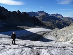
SDC11226 Alex and the glacier approach (that for once was refreshingly straightforward – I do hate crevasse hopping!)

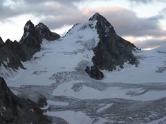
SDC11233 One of the stunning views of l’Eveque from the balcony of the Vignettes hut, an objective sadly abandoned due to the weather

SDC11287 The Vignettes hut, as seen on our way back down.

Alpine climbing is a wonderfully varied experience – from the hustle and bustle of Chamonix or Zermatt with their expensive shops and even more expensive uplift options (cable cars, trains etc), to quiet secluded village bases such as Arolla. Where you base yourself has a huge impact on your experience in the mountains, a place like Arolla granting you the very basic essence of it all – the mountains themselves all around you, with no flashy shops or expensive bars to distract you from what it’s all about. I liked it, lots, although I do still hate long hut walk-ins…

*Check out Alex’s blog: Glencoe Mountaineer.